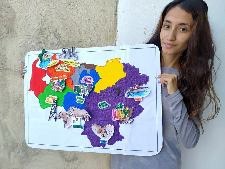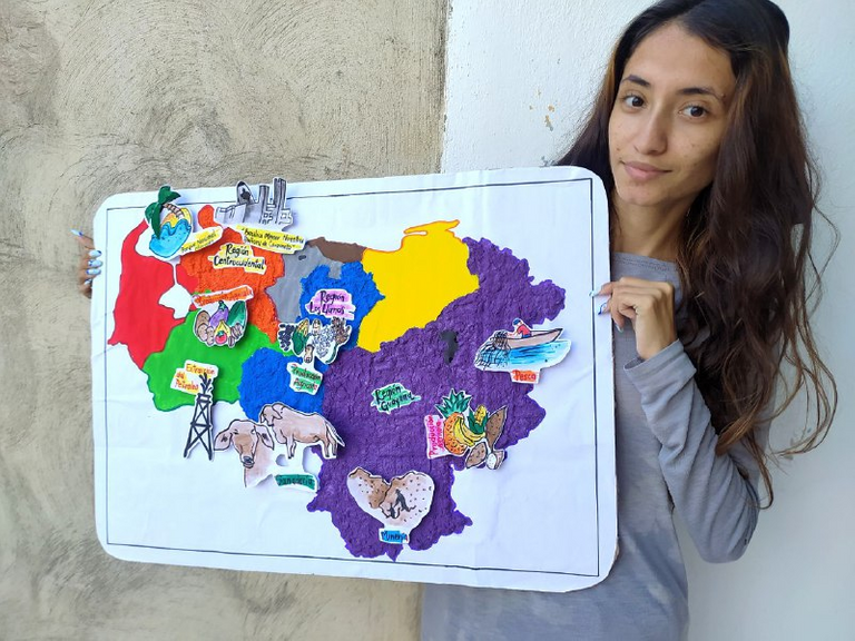
Hola Hive nuevamente les presento un nuevo trabajo hecho a mano y en esta ocacion les presento un mapa de mi país dibujado además de utilizar una mezcla usando papel y pegamento, me gusta utilizar este tipo de técnica ya que se pone como una piedra literal además de durar muchísimo tiempo y ser firme y fuerte que es lo más importante, fue un trabajo el cual me tocó realizar para la universidad, asi que decidi destacarme y comenzar con toda la creatividad del mundo para hacer un trabajo bonito y hermoso a la vista.
En esta ocasión como dije anteriormente es un mapa de Venezuela en donde debemos identificar las diferentes regiones de nuestro país incluyendo la principal producción de cada región, como el petróleo, la ganadería, agricultura minería entre otras producciones naturales de venezuela, realizando diferentes dibujos y colocándolos en las regiones, fue muy divertido realizarlo así que vamos con cada uno de los pasos y espero que te guste asi que comencemos! 💛
Hello Hive again I present a new handmade work and this time I present a map of my country drawn in addition to using a mixture using paper and glue, I like to use this type of technique because it gets like a literal stone besides lasting a long time and be firm and strong which is the most important thing, was a job which I had to do for college, so I decided to stand out and start with all the creativity in the world to make a nice and beautiful work in sight.
This time as I said before is a map of Venezuela where we must identify the different regions of our country including the main production of each region, such as oil, livestock, agriculture, mining and other natural productions of Venezuela, making different drawings and placing them in the regions, it was fun to do it so let's go with each of the steps and I hope you like it so let's get started! 💜

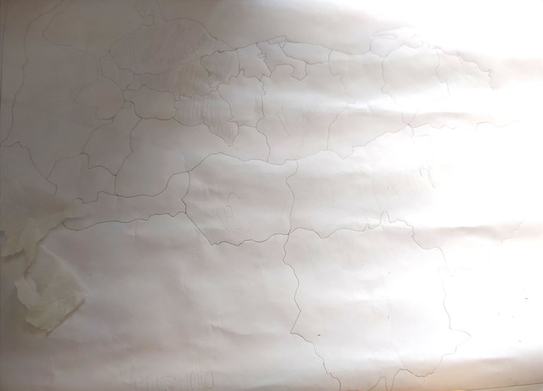
Comencé dándole forma haciendo un boceto del mapa de mi país Venezuela usando únicamente un lápiz de grafito HB #2 sobre papel de un tamaño 65.5 cm de ancho x 46 cm largo
I started by making a sketch of the map of my country Venezuela using only a graphite pencil HB #2 on paper of size 65.5 cm wide x 46 cm long.

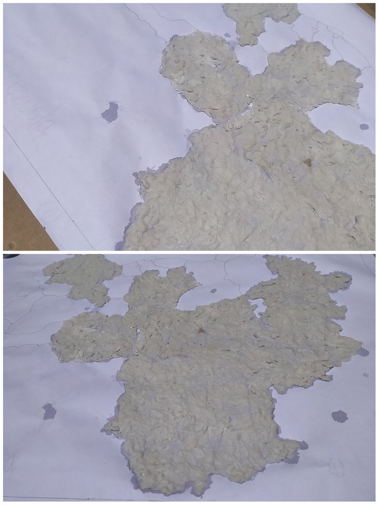
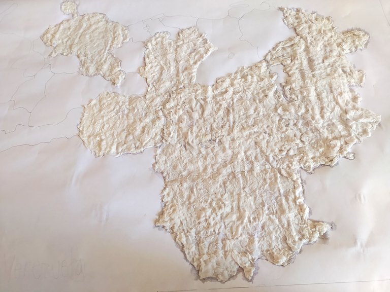
Agregue la textura sobre el papel haciendo uso de un engrudo especial el cual es una mezcla de agua con pegamento blanco líquido así como también trozos de papel en este caso se puede usar papel de baño o toallitas de cocina.
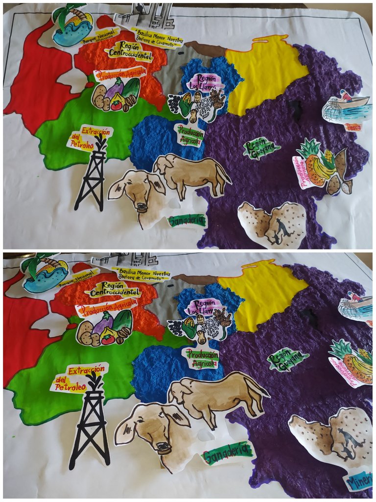
Dentro de estas mismas fotografías se puede visualizar cómo quedó al momento de culminar de llenar la textura de las regiones correspondientes.
Add the texture on the paper using a special paste which is a mixture of water with white liquid glue as well as pieces of paper in this case you can use toilet paper or kitchen towels.
In these same photographs you can see how it looked like when you finish filling the texture of the corresponding regions.

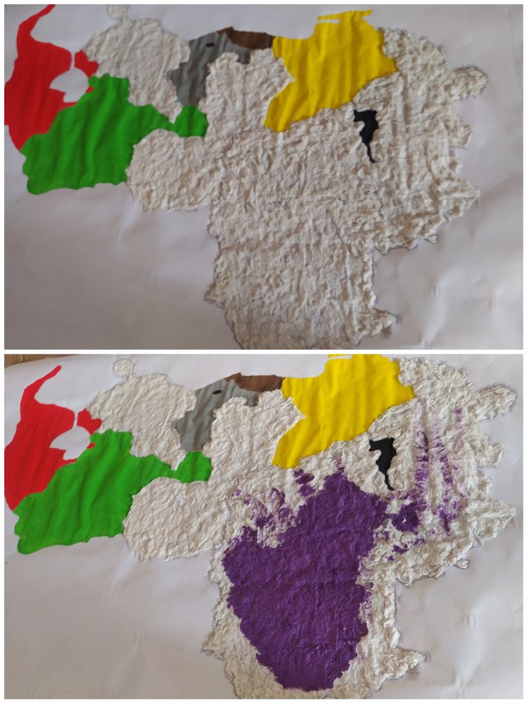
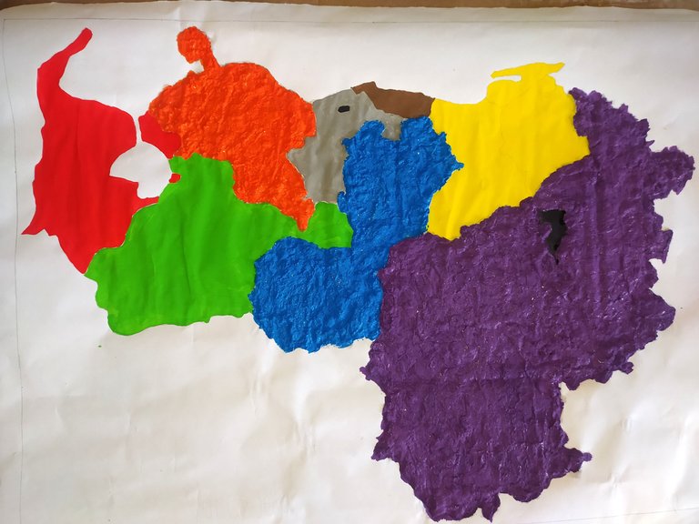
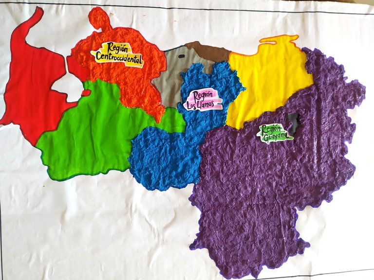
Seguí está producción creativa pintando el mapa por regiones y aún a pesar de que algunos de los colores que usé en la cartografía se usa para referentes al agua, vegetación y desierto me pareció conveniente usarlos ya que cada uno de ellos representan las regiones del país.
¡Para este punto ya comenzaba a verse muy bonito! ¿No crees?
I followed this creative production by painting the map by regions and even though some of the colors I used in the cartography are used to refer to water, vegetation and desert I thought it was convenient to use them since each of them represent the regions of the country.
By this point it was starting to look pretty nice, don't you think?

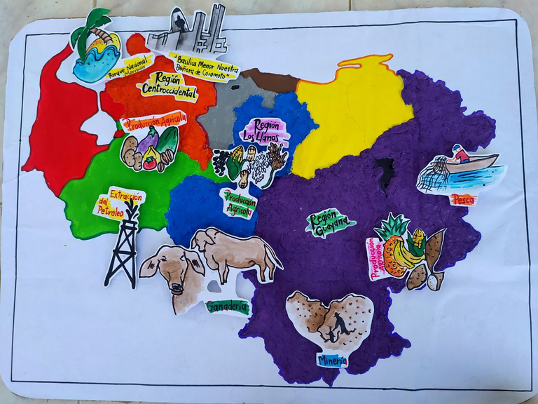
Identifique región por región haciendo uso de títulos escritos a mano con un fondo especial en un color que resalta en la lámina. Además de eso comencé agregar lo principal de la lámina que en este caso era las actividades económicas se representa tres regiones en específico.
Para este momento las regiones sobre las que yo decidí estudiar son:
Región Centro occidental
Región Los llanos
Región Guayana
I identified region by region using handwritten titles with a special background in a color that stands out on the sheet. In addition to that I started adding the main part of the sheet, which in this case was the economic activities represented in three specific regions.
For this moment the regions that I decided to study are:
West Central Region
Los Llanos Region
Guayana Region
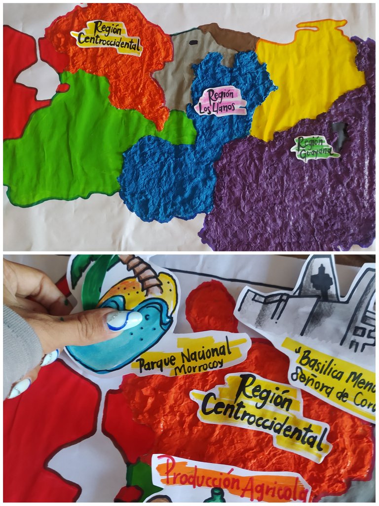

Acá ya podemos observar las actividades más resaltantes de cada una de las regiones fuí muy creativa y agregue una a una de ellas en tercera dimensión haciendo los sobresalientes por sobre la lamina La región centro-occidente se destaca más que todo porque tiene zonas turísticas las cuales brindan mucha vida a la región y muchas personas del interior del país viene a visitar sus playas y hermosos monumentos.
Aquí resalté el parque nacional Morrocoy 🏖️
La Basílica Menor nuestra señora de Coromoto 🏰
Así como también la producción agrícola dentro de los cuales destacan: Tomate 🍅 Cebolla 🧅 Berenjena 🍆 Pepino 🥒 Papas 🥔 Café ☕
- Pasando a La región de los llanos con la Extracción de petróleo 🛢️ La ganadería 🐮 y la producción agrícola de: Maíz 🌽 Maní 🥜 Arroz 🍚 Granos 🍛 Sorgo 🌾
Mientras que La región Guayana se destaca por la minería ⛏️ pesca 🐟 y producción agrícola de Piña 🍍 Plátanos 🍌 Maíz 🌽 Yuca
Here we can already see the most outstanding activities of each of the regions I was very creative and added one by one of them in third dimension making the highlights on the sheet The central-west region stands out mainly because it has tourist areas which bring a lot of life to the region and many people from the interior of the country come to visit its beaches and beautiful monuments.
Here I highlighted the Morrocoy National Park 🏖️
The Minor Basilica of Our Lady of Coromoto 🏰
As well as the agricultural production within which stand out: Tomato 🍅 Onion 🧅 Eggplant 🍆 Cucumber 🥒 Potatoes 🥔 Coffee ☕
- Moving on to The plains region with Oil extraction 🛢️ Livestock 🐮 and agricultural production of: Corn 🌽 Peanuts 🥜 Rice 🍚 Grains 🍛 Sorghum 🌾.
While The Guayana region stands out for mining ⛏️ fishing 🐟 and agricultural production of Pineapple 🍍 Bananas 🍌 Corn 🌽 Cassava
